Southern Ridges and Henderson Waves: the complete trail guide for 2026
What are the Southern Ridges and is the hike worth doing?
The Southern Ridges is a 9-km network of connected hilltop parks and forest trails linking Labrador Park to Mount Faber. The highlight is Henderson Waves — Singapore's highest pedestrian bridge at 36 metres above the forest floor, with a distinctive undulating wooden design. The trail is mostly shaded, mostly free, and genuinely scenic. It is the best urban forest hike in Singapore and can be done comfortably in 3–4 hours.
Quick answer: The Southern Ridges is Singapore’s best urban forest trail — free, well-maintained, mostly shaded, and passing the spectacular Henderson Waves bridge. Allow 3–4 hours for the full trail or 90 minutes for the Henderson Waves section from Telok Blangah MRT. Best done in the morning.
| Where | Labrador Park to Mount Faber, south Singapore |
| Cost | Free (cable car at Mount Faber is optional/paid) |
| Time needed | 3–4 hours full trail; 90 min for Henderson Waves section |
| Getting there | Telok Blangah or Labrador Park MRT (Circle Line) |
| Best time | 7am–10am, or after 6pm for the lit bridge |
What the Southern Ridges is
The Southern Ridges is a 9-kilometre chain of hilltop parks on the southern fringe of Singapore, connected by elevated walkways, forest paths, and two signature bridges. The trail links Labrador Park in the west to Mount Faber in the east, passing through several distinct park environments along the way.
It is not a wilderness trail. Singapore’s Southern Ridges passes through managed parks, alongside residential areas, and crosses multiple road bridges — but the trail sections through the forest genuinely feel removed from the city, particularly the Forest Walk elevated walkway and the Henderson Waves bridge. On a weekday morning you can walk substantial stretches without seeing many other people.
The trail is the result of a significant NParks initiative that began in 2002, connecting parks that had previously been isolated. The result is Singapore’s most practical urban hiking experience.
The sections of the trail
Labrador Park (western start)
Labrador Nature Reserve is the western terminus of the Southern Ridges. It occupies a rocky headland with views over the Strait of Malacca and good birdwatching. The park has remnants of WWII coastal defences — tunnels, bunkers, and an artillery battery — which are accessible on a heritage trail. Labrador is pleasant in its own right but is a detour from the main Henderson Waves experience if you are short on time.
Access: Labrador Park MRT station (Circle Line).
Alexandra Road to HortPark
The trail crosses Alexandra Road and enters HortPark — a “one-stop horticulture lifestyle destination” with demonstration gardens, a nursery, and food options. This section is pleasant but not the highlight. HortPark is a useful rest point with toilets and water.
Forest Walk
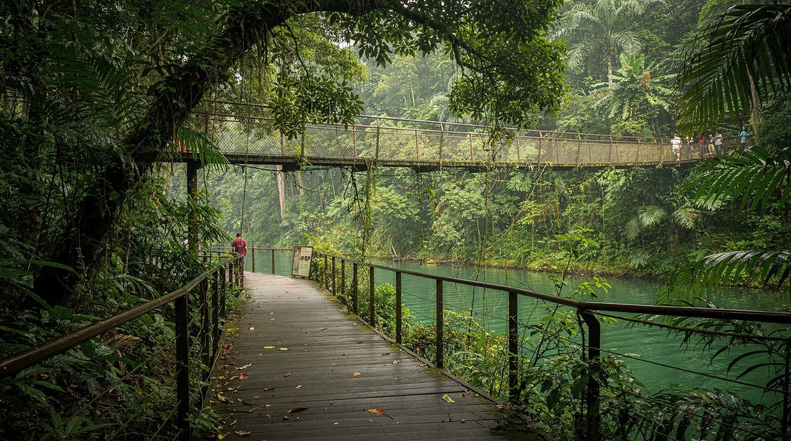
The Forest Walk is a 1.3-km elevated steel walkway at canopy height, winding through the forest between HortPark and Henderson Waves. This section is genuinely good — the walkway lifts you to 5–20 metres above the ground, giving eye-level views into the tree canopy. The forest here has a mix of secondary growth and some larger primary species. Birds (including various sunbirds, bulbuls, and woodpeckers) are active at canopy level in the morning.
The walkway is accessible (no significant inclines, wide enough for wheelchairs in most sections). It is entirely shaded.
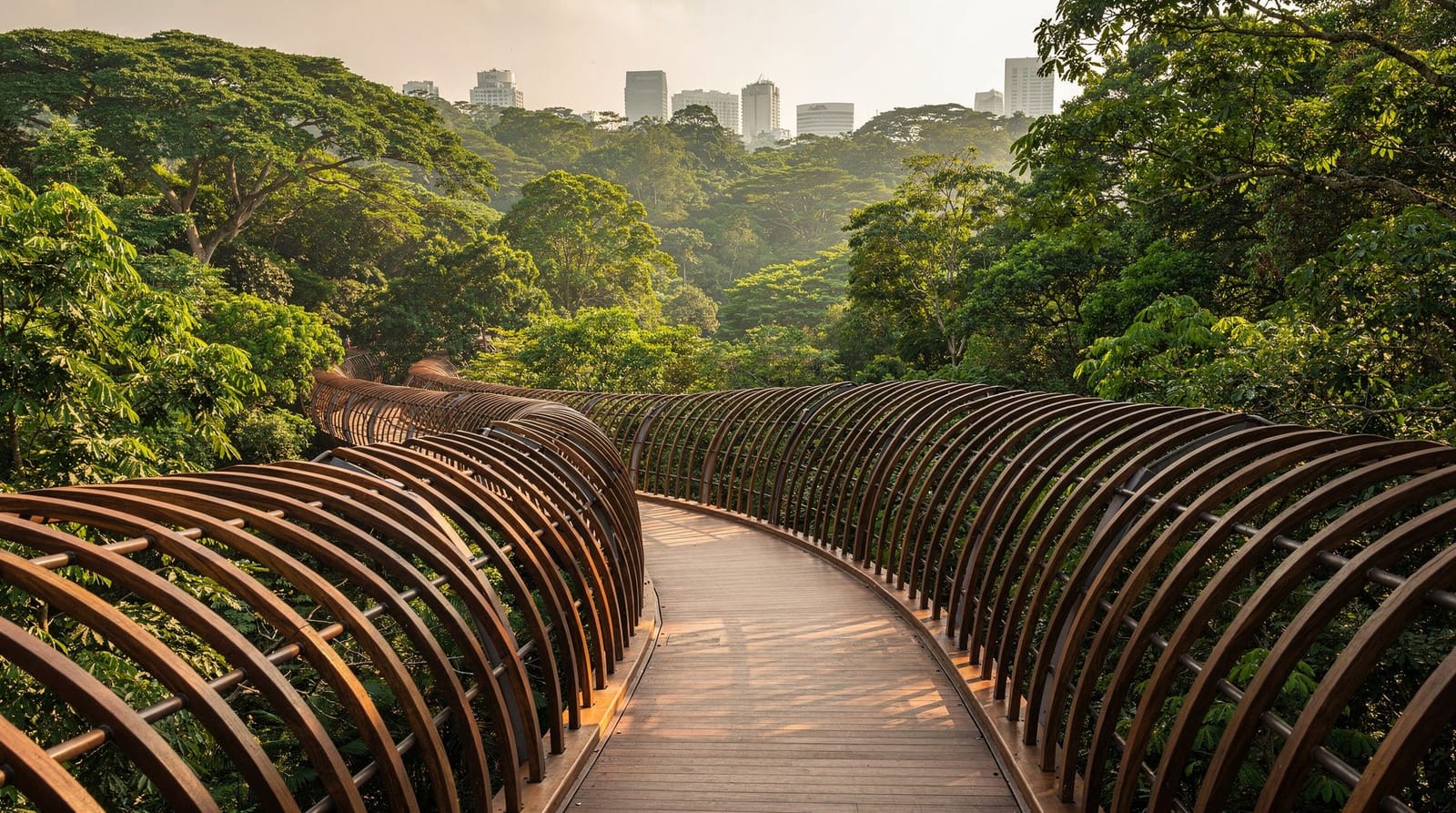
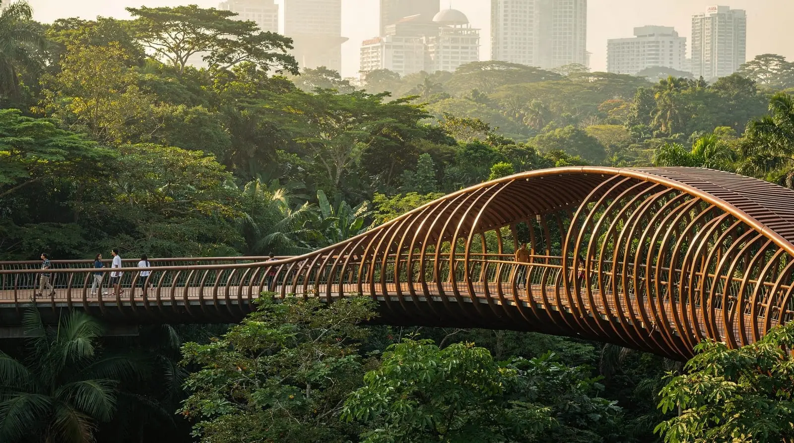
Henderson Waves bridge
The centrepiece of the Southern Ridges. Henderson Waves is a 274-metre pedestrian bridge that connects Telok Blangah Hill Park and Mount Faber Park, arching 36 metres above the Henderson Road valley. The bridge’s most striking feature is the undulating form — it waves up and down along its length, creating a series of sheltered alcoves with wave-shaped wooden ribs on either side.
The bridge is made from yellow balau wood (a tropical hardwood) and steel. At any time of day it is photogenic; at dusk, it is lit from below and the effect is striking.
The bridge gives views south (towards Sentosa and the Singapore Strait) and north (toward the residential areas of the south-central island). The vegetation in the valley below is mature secondary forest.
Walking the bridge takes about 5 minutes. Most people stop multiple times for photos.
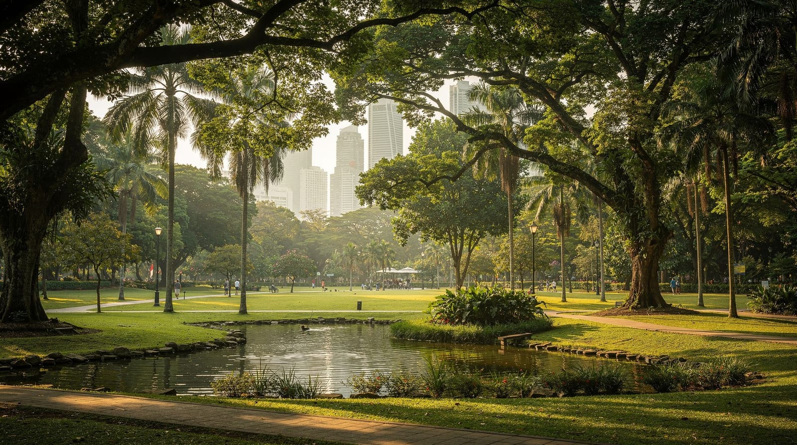
Telok Blangah Hill Park
The park around Henderson Waves includes the Terrace Garden — a series of layered terraces cut into the hillside with views toward the harbour and Sentosa. The terraces are good for a rest with a view. Several heritage trees are marked along the path from the bridge to the MRT.
Access: Telok Blangah MRT station (Circle Line) is about 20 minutes’ walk from the Henderson Waves bridge. This is the most practical point to enter or exit the trail for a Henderson Waves-specific visit.
Mount Faber Park (eastern end)
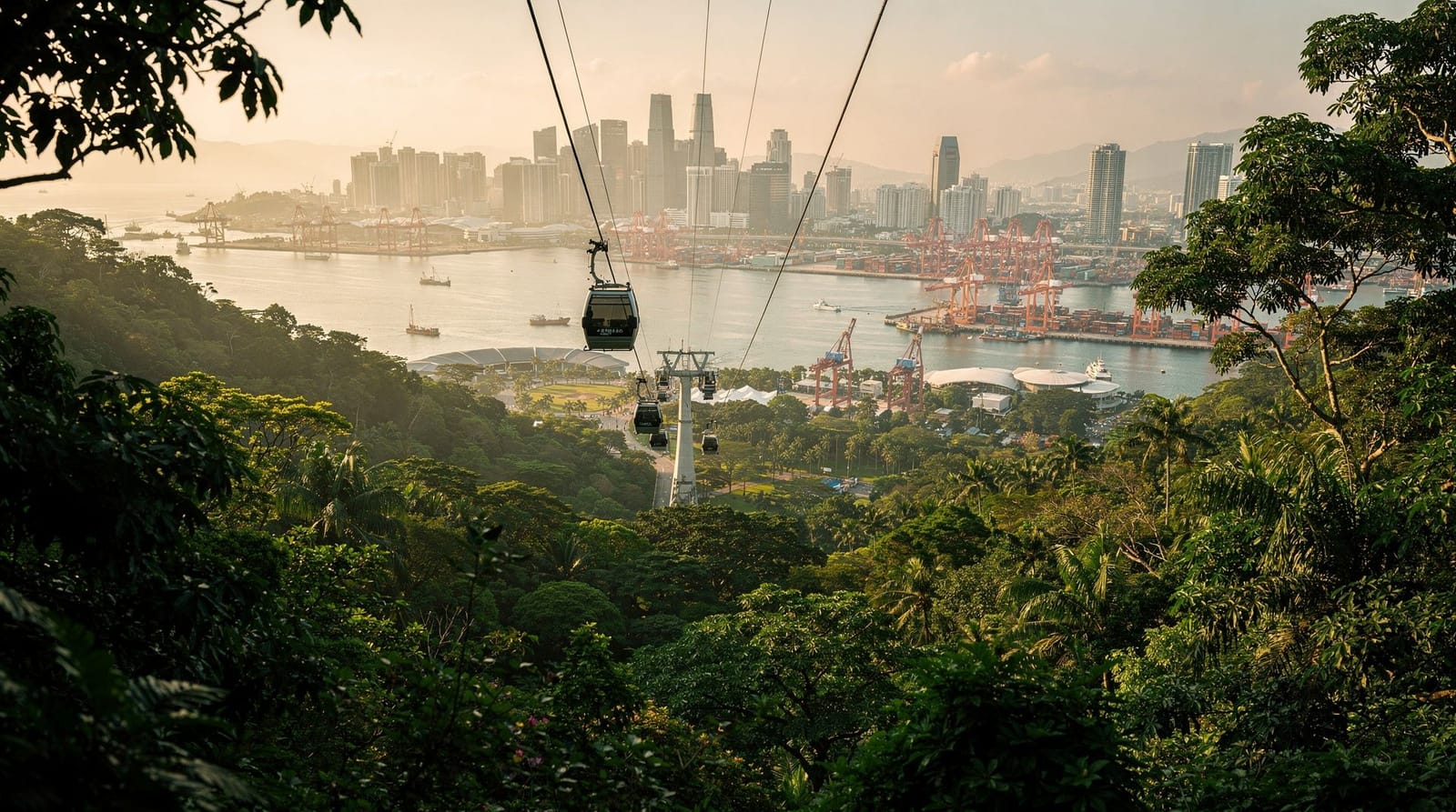
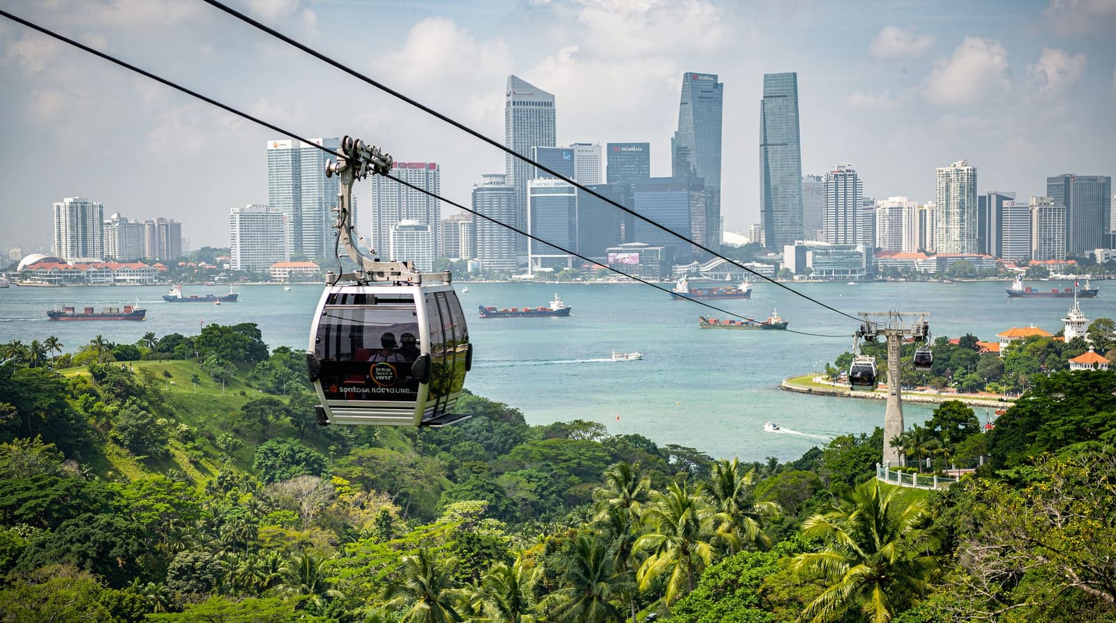
The trail ends at Mount Faber Park, the forested hill at the eastern end of the Southern Ridges. Mount Faber (105 metres) offers views over the Singapore harbour, Sentosa, and the Keppel area. The park has a restaurant, the Faber restaurant with harbour views, and the upper cable car station (connecting to HarbourFront and Sentosa).
On clear evenings, Mount Faber is a good sunset viewpoint. The cable car descent is a practical way to return to HarbourFront after the hike if you want to avoid retracing your steps.
Planning your hike
Recommended half-day route (3–4 hours)
- Take the MRT to Telok Blangah station
- Walk from the station to Henderson Waves (20 minutes)
- Cross Henderson Waves and explore the Forest Walk (30 minutes)
- Continue to HortPark for water and rest (20 minutes)
- Return via Forest Walk and Henderson Waves
- Walk up to Mount Faber for the view (30 minutes from Henderson Waves)
- Return to HarbourFront via cable car or by walking down to HarbourFront station (20 minutes downhill)
Alternatively: start at Labrador Park MRT and walk the full trail east to Mount Faber (3–4 hours), then cable car back to HarbourFront.
Timing
Best time: 7am–10am. The trail is shaded but Singapore’s heat peaks from 11am–3pm. An early start means cooler conditions, more active wildlife, and softer morning light for photography.
Henderson Waves at dusk: The bridge is lit from 7pm onwards. An evening walk from Telok Blangah MRT (after 6pm) gives a different and equally good experience — cooler, lit bridge, and evening views. Bring a torch/phone torch for the unlit forest sections.
Wildlife on the trail
The Southern Ridges forests harbour more wildlife than you might expect from a trail in a major city. Regular sightings include:
- Long-tailed macaques (throughout the forest sections — do not feed them)
- Sunbirds (olive-backed and crimson sunbirds), bulbuls, and mynahs along the canopy walk
- Monitor lizards (Malayan water monitors) near Labrador Park
- Butterflies throughout, particularly near HortPark
The forests are secondary growth but have developed enough over 30–50 years to support a reasonable canopy bird community.
Practical information
Cost: Entirely free.
Difficulty: Easy to moderate. Suitable for reasonably fit visitors; not suitable for those who cannot manage hills or uneven surfaces on some sections.
What to wear: Comfortable walking shoes (not flip-flops). Light clothing, hat, sunscreen for exposed sections near Mount Faber. Insect repellent recommended.
Water: Bring water — Singapore dehydrates walkers faster than the temperature suggests. Water fountains are available at HortPark and at the ends of the trail.
Trail maps: Available on the NParks website and app. Download offline before going.
Connecting to Sentosa
Mount Faber’s cable car gives direct access to Sentosa from the end of the Southern Ridges hike. A morning hike from Labrador Park to Mount Faber followed by the cable car to Sentosa for an afternoon beach session is a practical combination for visitors wanting variety. Full cable car details at the Sentosa cable car guide.
Book the Mount Faber to Sentosa cable carWhat to see along the way besides Henderson Waves
Henderson Waves gets most of the attention, but the trail has several smaller highlights worth slowing down for:
The Marang Trail and Faber Point: Near Mount Faber, a short detour leads to Faber Point, a quieter viewpoint than the main cable car station, with harbour views and fewer crowds.
HortPark’s demonstration gardens: A pleasant, low-key stop with themed planting displays — genuinely worth 15–20 minutes if you enjoy gardens, and a sensible place to fill water bottles before the Forest Walk.
Alexandra Arch and Interlace public housing: The trail passes distinctive modern architecture, including the Alexandra Arch bridge and views of “The Interlace” residential complex — an internationally recognised piece of architecture visible from the trail.
Canopy-level birdwatching on the Forest Walk: Early morning (before 9am) gives the best chance of spotting sunbirds and woodpeckers at eye level from the elevated walkway — bring binoculars if birdwatching is a specific interest.
Frequently asked questions about the Southern Ridges
Do I need a guide for the Southern Ridges trail?
No — the trail is well-marked, signposted, and easy to follow. The NParks website and app have downloadable maps. Most sections have multiple points where you can exit to a road if needed.
Can I cycle the Southern Ridges?
The Forest Walk elevated walkway and Henderson Waves bridge are pedestrian-only — cycling is not permitted. Some sections on park roads and HortPark paths allow cycling. For cycling in Singapore’s parks, East Coast Park is the primary cycling destination.
Is Henderson Waves wheelchair accessible?
The bridge itself is wheelchair accessible. The Forest Walk elevated walkway is largely accessible. Some sections of the full trail, particularly the Mount Faber ascent and parts of Labrador Park, have steps or steep gradients. The Henderson Waves section from Telok Blangah MRT is the most accessible part of the trail.
What happens in the rain on the Southern Ridges?
The trail can be muddy in wet sections (particularly Labrador Park). Henderson Waves and the Forest Walk have some weather protection. Singapore’s rain is usually afternoon thunderstorms — a morning hike avoids the worst of it. If lightning is forecast, avoid the elevated walkways.
How does the Southern Ridges compare to MacRitchie Treetop Walk?
Both are elevated canopy trail experiences, but they are different. Southern Ridges is longer, more urban, and includes the spectacular Henderson Waves bridge. MacRitchie Treetop Walk is deeper in genuine secondary rainforest with more wildlife. See the MacRitchie guide for the comparison. Both are worth doing on a Singapore visit.