Southern Ridges
Southern Ridges is Singapore's best urban walking trail — 9 km of connected forest ridgeline from Mount Faber to Labrador, crossing Henderson Waves bridge.
Quick facts
- Trail length
- 9 km total (Telok Blangah Hill to Labrador via Henderson Waves and HortPark)
- Elevation
- Mostly 50–100 m; Henderson Waves bridge at 36 m above the valley floor
- Entry cost
- Free throughout; no registration needed
- MRT access
- Labrador Park (Circle Line) for south end; HarbourFront + Faber Peak for north
- Best section
- Henderson Waves to Alexandra Arch — the architectural and forest highlight
The Southern Ridges trail is the answer to a question visitors rarely think to ask: what does Singapore look like from above the buildings, on foot, through actual forest? The 9-kilometre ridgeline walk connects Mount Faber, Telok Blangah Hill, the Henderson Waves bridge, Alexandra Arch, HortPark, and Labrador Nature Reserve in a mostly continuous green corridor. It is free, largely shaded, and offers a perspective on Singapore that the city’s waterfront promenades and observation decks do not — the sense of the island as a landscape rather than a built environment.
The route is not wilderness. You are never far from roads, and occasional glimpses of HDB housing and industrial infrastructure remind you where you are. But the forest canopy is genuine secondary forest with good biodiversity, the elevation is enough to provide views, and Henderson Waves — the undulating timber and steel pedestrian bridge crossing a forested valley — is one of the more architecturally interesting structures Singapore has produced in recent decades.
| Where | Mount Faber to Labrador Nature Reserve, southern Singapore |
| Cost | Free throughout; no registration needed |
| Time needed | 3–4 hours for the full 9 km trail; 45–90 min for Henderson Waves alone |
| Getting there | HarbourFront MRT for the north end; Labrador Park MRT (Circle Line) for the south end |
| Best time | Early morning (07h–09h) or late afternoon (16h–18h) |
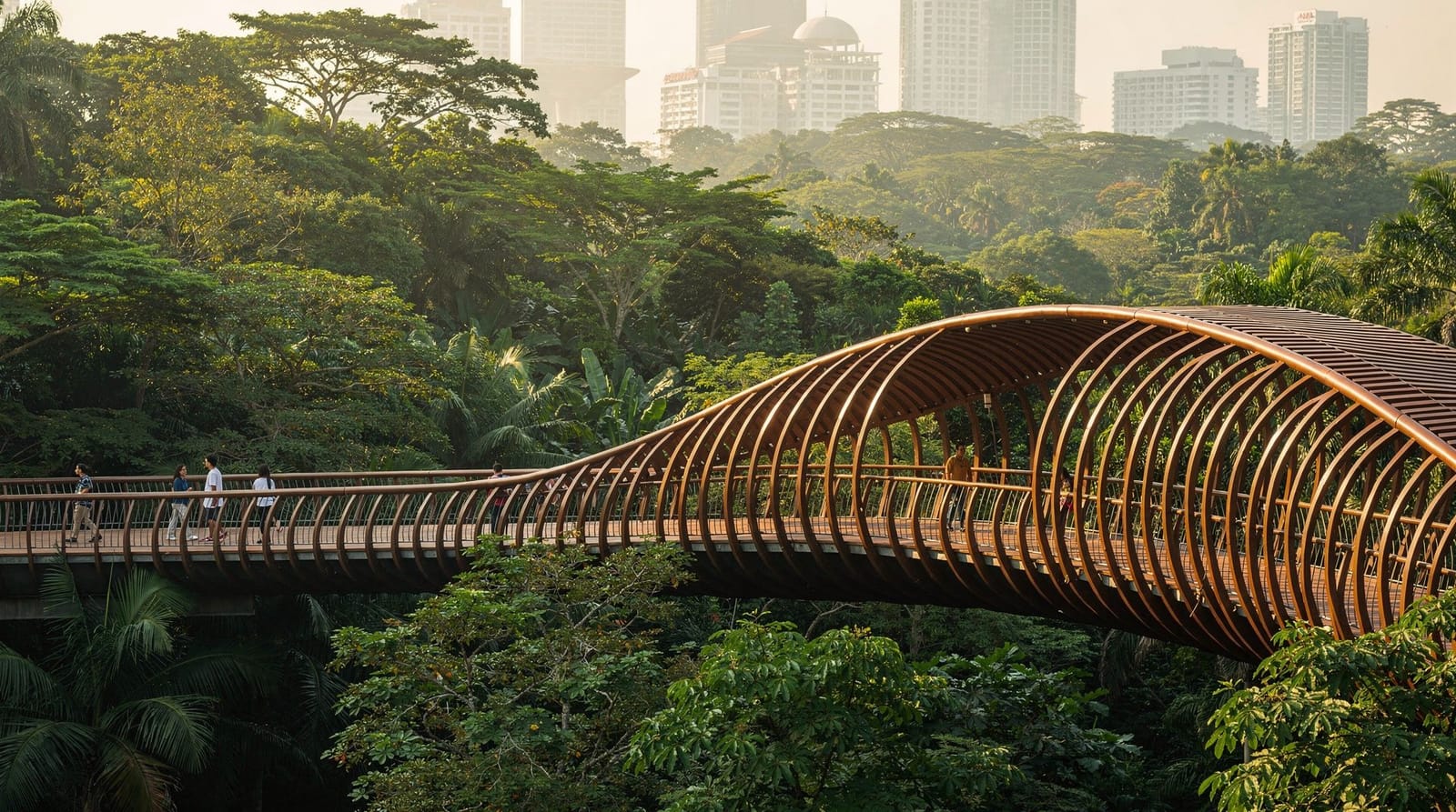
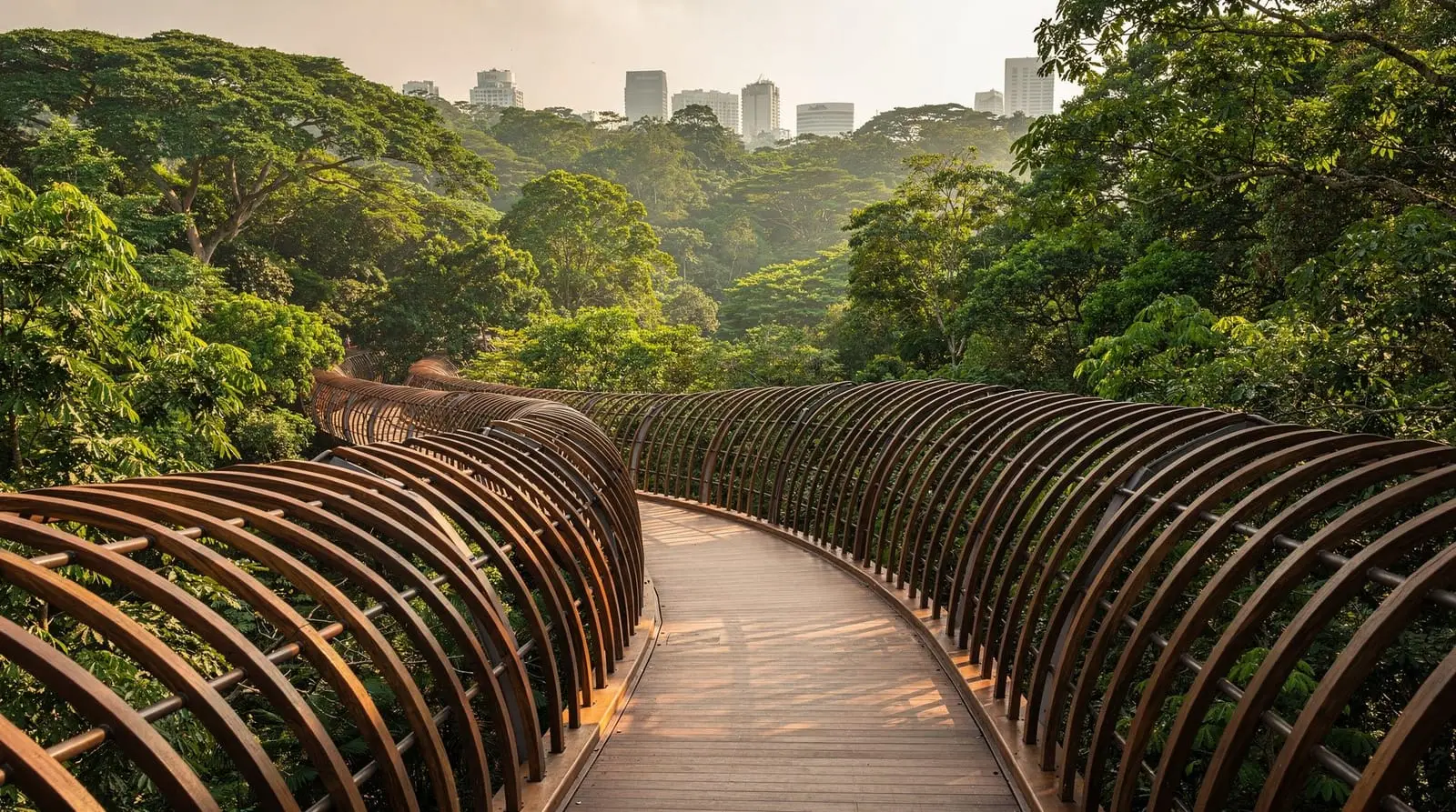
Henderson Waves — the signature structure
Henderson Waves opened in 2008 at the junction between Telok Blangah Hill Park and Mount Faber Park. The bridge spans 274 metres across Henderson Road at a height of 36 metres above the valley floor. Its defining feature is the wave-form ribbed structure of curved steel ribs and yellow balau timber decking — the undulations create sheltered alcoves along the bridge deck where visitors sit to rest or watch the tree canopy at eye level.
At 09h on a weekday, with a light mist from the morning humidity in the valley below, Henderson Waves earns its reputation as one of Singapore’s genuinely photogenic locations. At 13h on a weekend with tour groups, the bridge still looks fine but the experience changes. Timing matters more here than at most city attractions.
The structural engineering (designed by RSP Architects Planners and Engineers) was shortlisted for the World Architecture Festival and won multiple awards on opening. Whether or not architecture is your interest, the bridge works as an experience — the views through the steel ribs into the forested valley are distinctive in a way that the flat walkways elsewhere in Singapore are not.
The full trail — section by section
Mount Faber to Telok Blangah Hill (1.5 km): Begins at the Faber Peak cable car station or the car park on Morse Road. The path descends from the Mount Faber summit to a saddle, then rises to Telok Blangah Hill. Moderate gradient; mostly forested. Allow 30–40 minutes.
Telok Blangah Hill to Henderson Waves (1 km): Continuing south from Telok Blangah Hill summit through forest. The trail is well-maintained and the descent to Henderson Waves is signposted. Allow 20–25 minutes.
Henderson Waves to Alexandra Arch (1.5 km): The most interesting section for most visitors. Cross Henderson Waves, descend to the forest path, and follow the trail to Alexandra Arch — a leaf-shaped steel arch bridge that crosses Alexandra Road. The forest between the two bridges contains good birdlife (sunbirds, bulbuls, and occasionally hornbills) and frequent monitor lizard sightings along the path edges.
Alexandra Arch to HortPark (0.5 km): A short connector to HortPark — Singapore’s gardening hub, free entry, with themed display gardens, a rooftop garden centre, and the Tree Top Walk suspension walk within HortPark’s own network. Worth a 20–30 minute pause.
HortPark to Labrador Nature Reserve (2 km): The trail continues south through Labrador Nature Reserve — a stretch of coastal secondary forest with British-era gun emplacements from WWII, sea views over the strait, and birdlife along the coastal vegetation edge.
Labrador Park MRT (Circle Line): The southern terminus. A 5–10 minute walk from the reserve exit to the MRT station.
Practical trail information
Direction: Most guides recommend walking north to south (Faber Peak / HarbourFront end → Labrador Park), which puts Henderson Waves roughly in the middle of the walk and means you finish at an MRT station. Starting at Labrador Park and walking north works equally well — you hit Henderson Waves as the climax rather than the midpoint.
Distance and time: The full trail (Faber Peak to Labrador Park) is approximately 9 km. At a comfortable pace with photography stops: 3–4 hours. The Henderson Waves section only (walking from the Alexandra Road Car Park off Henderson Road) can be done in 45–90 minutes.
Footwear: Regular trainers are adequate on the main trail. After heavy rain, the unpaved sections can be muddy — trail running shoes or light hiking footwear is better if you have it.
Water: Bring at least 750 ml per person. Vending machines are available at Telok Blangah Hill Park’s facilities and at HortPark; there are no consistent water points on the trail itself.
Facilities: Toilets at Telok Blangah Hill Park summit, HortPark, and Labrador Nature Reserve. No restaurants on the trail; the HortPark café is the main option for a break.
Wildlife on the Southern Ridges
The Southern Ridges corridor is ecologically connected to the Central Catchment Nature Reserve via the Bukit Timah–Southern Ridges green network, meaning species move between the two areas. What you reasonably expect to see:
Monitor lizards: Almost certain, particularly near the forest floor sections between Alexandra Arch and HortPark. Singapore monitors (Varanus salvator) are common throughout the urban green corridors and reach substantial size — 1.5–2 metres is not unusual.
Birds: The forest edges and the clearings near HortPark are productive for sunbirds, flowerpeckers, bulbuls, and the distinctive Asian koel (heard before seen). Oriental pied hornbills are seen on the Faber-Telok Blangah section occasionally.
Long-tailed macaques: Present throughout but in smaller concentrations than at Bukit Timah. The same cautions apply — do not feed, keep food sealed.
Starting with breakfast at Faber Peak
For a structured start to the walk rather than arriving cold, a guided breakfast at Faber Peak before setting off gives context on the trail ahead and the cable car option for later in the day. It suits visitors who want the Southern Ridges combined with the Mount Faber viewpoint without planning the logistics themselves.
Faber Peak walk and breakfast experienceSouthern Ridges vs Bukit Timah, at a glance
| Southern Ridges | Bukit Timah | |
|---|---|---|
| Length | 9 km, mostly flat ridgeline | Shorter, but steeper climbs |
| Character | Bridges, forest, sea views, architectural | Wilder, primary rainforest |
| Ecology | Secondary forest, good but moderate biodiversity | Singapore’s richest forest reserve |
| Best paired with | Sentosa via cable car | A dedicated half day on its own |
Combining Southern Ridges with other west-side destinations
The Southern Ridges sits at the heart of Singapore’s southern green corridor and connects naturally with:
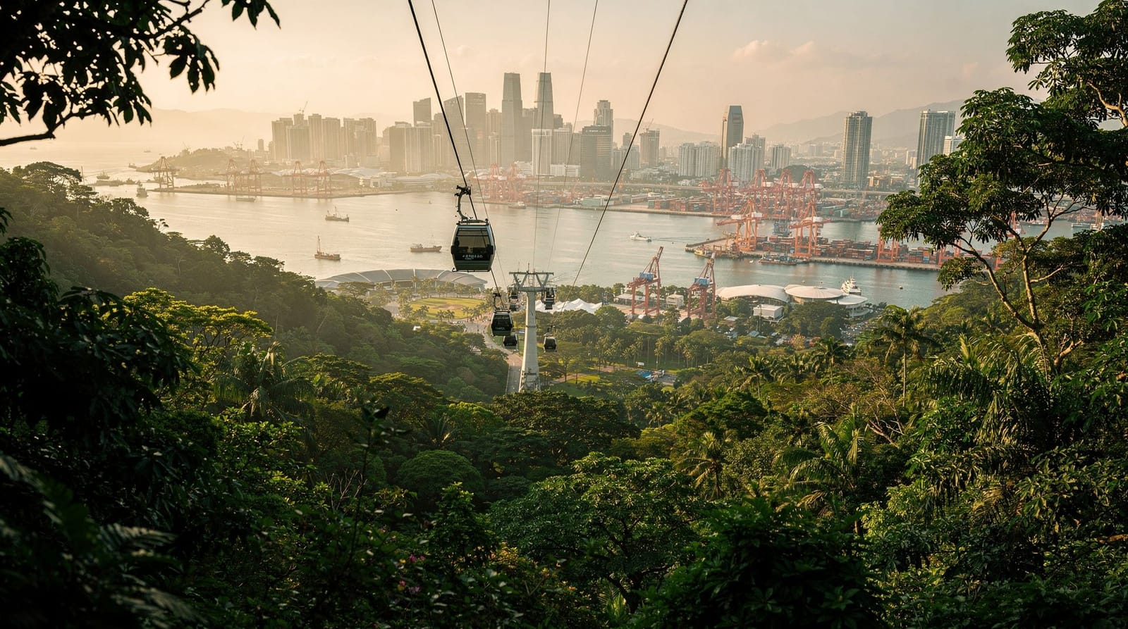
Mount Faber: The northern terminus — see the Mount Faber guide for the cable car option and hilltop restaurants. A natural combination for an afternoon walk followed by sunset drinks.
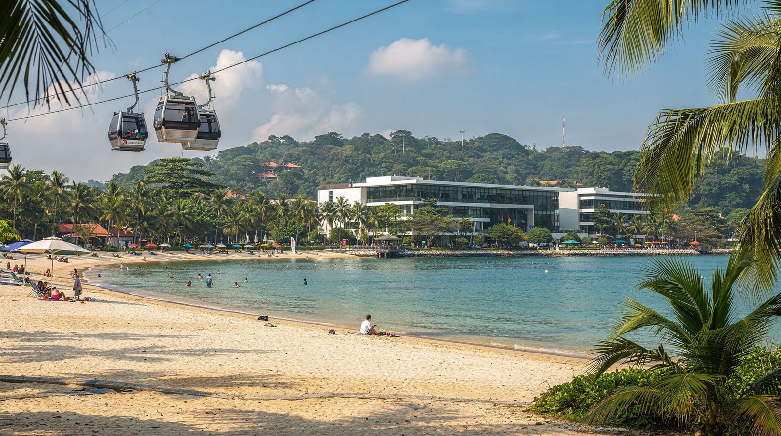
Sentosa: A cable car from HarbourFront (near the Mount Faber end) drops you onto Sentosa in 10 minutes. If combining Southern Ridges with a Sentosa evening, start early at Labrador Park, walk north, and cable car across in the late afternoon.
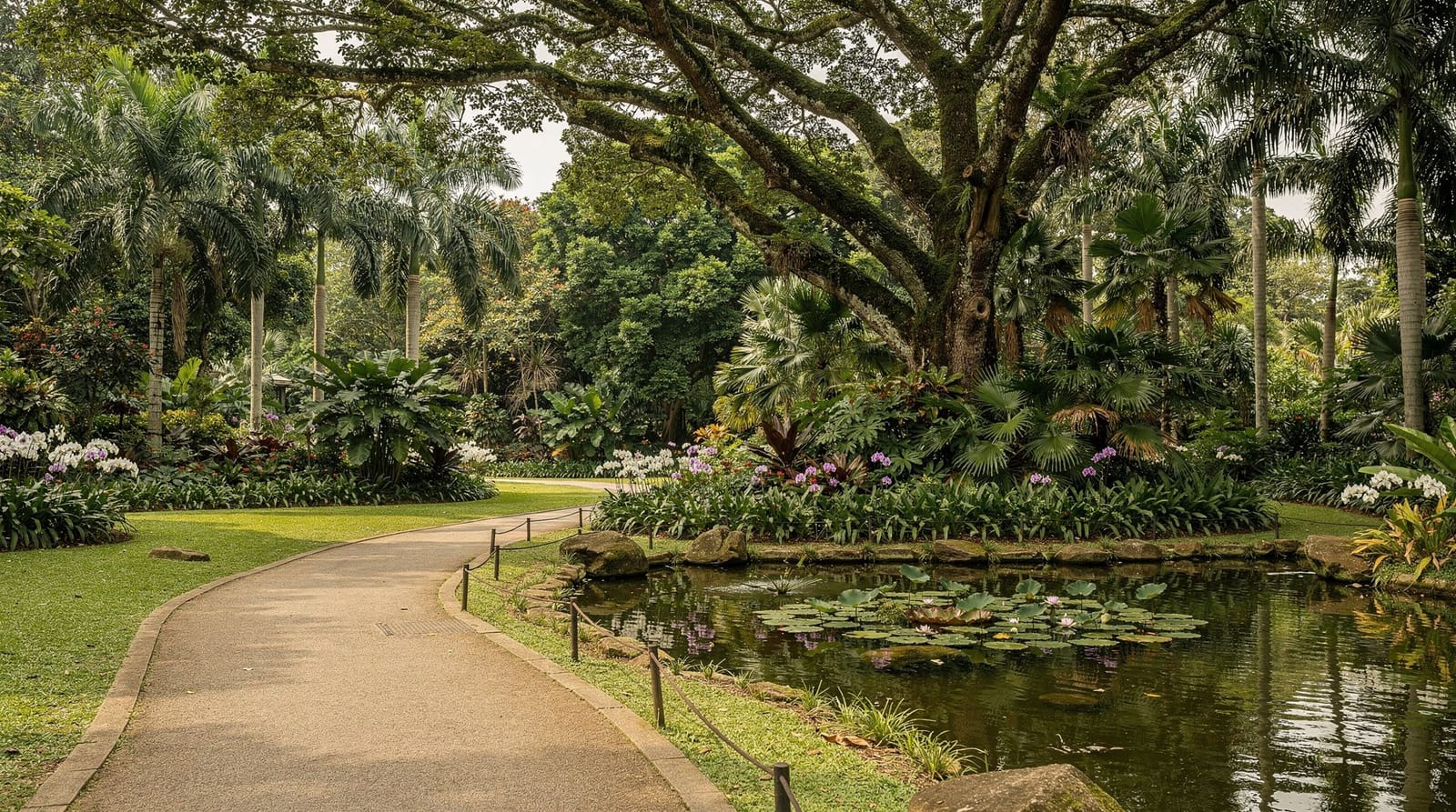
Botanic Gardens: 30–40 minutes by taxi from the Labrador Park end, or 40 minutes by MRT via Redhill. A longer day combining both requires an early start.
Bukit Timah Nature Reserve: Not directly connected, but both are excellent half-day nature walks that work as a combined full-day itinerary. The Bukit Timah hike guide covers that side of things.
Frequently asked questions about Southern Ridges
Is the Southern Ridges walk suitable for beginners?
Yes. The gradients are moderate and the main trail is well-maintained and clearly signed. The longest continuous ascent is roughly 80 metres over about 800 metres of path — challenging in Singapore’s heat but not technically difficult. Children who can walk 5+ km regularly will manage the full trail.
How do I reach the start of the walk?
The most convenient start for most visitors is HarbourFront MRT (Circle Line or North-East Line), then a 25–30 minute walk or cable car to Mount Faber. Alternatively, take a Grab/taxi directly to the Telok Blangah Hill Park car park or to the Henderson Road Alexandra Road Car Park (roadside drop-off point near Henderson Waves). The Labrador Park MRT (Circle Line) is the southern start or finish.
Can I cycle the Southern Ridges?
The Henderson Waves bridge and the forest trail sections are walking-only. The Rail Corridor (a converted railway line) is the cycling-friendly alternative in this part of Singapore — it runs parallel to the Southern Ridges route. The cycling Singapore guide covers the Rail Corridor in detail.
How does the Southern Ridges compare to Bukit Timah for a nature walk?
They are complementary rather than competing. Southern Ridges is longer, more varied (bridges, forest, sea views), and more architectural. Bukit Timah is wilder, higher, and more ecologically significant with its primary rainforest. Southern Ridges works well for a combined walk-and-urban day (finish near HarbourFront and cable car to Sentosa). Bukit Timah is better for those specifically interested in ecology and wildlife.
What is the best time of day to photograph Henderson Waves?
Morning (07h30–09h30) catches the softest light from the east, occasional low mist in the valley, and minimal crowds on weekdays. Late afternoon (16h30–18h00) produces warmer light from the west. Avoid midday when the overhead sun flattens the bridge’s wave structure. The bridge is lit at night (approximately 19h–22h) for a different, more graphic shot.
Is there parking at Henderson Waves?
There is limited roadside parking along Henderson Road near the Alexandra Road / Henderson Road junction. The nearest car park is at Telok Blangah Hill Park off Telok Blangah Way, about 15 minutes walk from Henderson Waves. Taxi or Grab drop-off at the bridge is straightforward.
Can I do just part of the Southern Ridges trail?
Yes, and most visitors do. The Henderson Waves to Alexandra Arch section is the most rewarding single stretch and can be reached directly by taxi to the Henderson Road car park, making it accessible without committing to the full 9 km. Combine with HortPark for a short café stop if you want more than just the bridge.